Reskarta-postereditor
Travel map of the countries you visited: your world, country by country
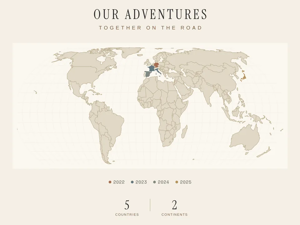
Which countries have you visited, and which are still on your list? Adventure Map keeps your travels on a world map. Mark the countries you have explored and make a print for your desk, living room or someone you enjoy travelling with.
You can add the travel year for each country. Countries from the same year share a colour, with a legend beneath the map. An optional statistics line counts countries, continents and the percentage of the world visited. Add a title or personal quote in the editor.
For the world map of the countries you have visited, choose from six colour worlds, from Midnight and Sand to Rose, and between the Classic and Minimal layouts. The Equal Earth projection shows the continents true to their area, while Mercator gives the classic, familiar map view. Without travel years, all visited countries share one colour, which you pick from the palette of your colour world.
Enter your trips and compare the colours and text in the preview. Decide whether the year labels or the map itself should stand out most. Check the marked countries before ordering, then choose the size and finish.
Frequently asked questions
How do I mark visited countries?
You select them in the editor and optionally add the year of the trip. Countries from the same year share one tone — the map reads like a journey through time. Dream destinations are marked separately and appear as dashed outlines without fill.
What does the stats line show?
If you like, the poster keeps count: how many countries and continents you have traveled and what share of the world you have explored. Dream destinations are not counted — the map stays honest.
Can the poster list the countries I have visited by name?
Yes, in the Classic layout. With country names switched on, your visited countries appear as a line below the map; dream destinations are not included. Add the years if you like, and the list follows the order of your travels, otherwise it runs alphabetically. Instead of names, the line can also show round flags that gather your journeys at a glance.
Can I show a travel route instead of countries?
Yes, with the Route map mode. Search for your destinations, add at least two and arrange the stops with the arrows. The map connects them in straight lines, not along the roads you travelled. Choose dot, ring, diamond or heart as the marker. Place names and years can be shown as you like, and the map can zoom in on your route.
Which sizes and materials are available?
There are six poster sizes from 30 × 40 cm to 70 × 100 cm. Every size is available as a premium paper print; canvas is available for almost all formats (DIN A3 excepted). Paper posters can additionally be ordered framed — in white, black or wood.
How do printing and shipping work?
Every poster is printed after you order — made to order, not stocked. Production happens with our print partner as close to you as possible; available shipping options and delivery times are shown transparently at checkout.